
I have written twice about the Towpath Trail which is being constructed along the route of the old Ohio & Erie Canal. I have already walked two small portions of the trail. Last week, on what might have been one of our last summery days of the year I walked along the northernmost stretch of the trail. I returned to the Cleveland neighborhood of Tremont which is located on the opposite side of the Cuyahoga River from downtown Cleveland. From there the trail descended into the river valley which we refer to as the Flats.
Passing over the trail is the George Voinovich Bridge which was completed in 2016 and which replaced the deteriorating Innerbelt Freeway bridge across the river.

Just beyond the span of the Voinovich Bridge are two stone pylons which are all that remain of the Central Viaduct. It was completed in 1888 to connect the east and west sides of Cleveland. Although it is dwarfed by the modern bridge, in its day the Central Viaduct was considered a marvel of engineering.

The trail descends to the Flats along the banks of the Cuyahoga River. Through much of the 20th century, when Cleveland was one of the nation's leading industrial cities, the Flats were lined with factories and steel mills. Although manufacturing has declined, much of the Flats remains an industrial area... interesting but certainly not one of the city's beauty spots.

Freighters still ply the river carrying cargos of iron ore, limestone, salt and coal. The ships must be less than 640 feet in length to navigate the many bends in the Cuyahoga. It is commonly thought that the name Cuyahoga comes from the Mohawk word Cayahaga which means "crooked river". But since the Mohawks never lived in this area, that is probably false. The origin of the word is not clear.
In order to allow ships to move along the river, many of the bridges were lift bridges in which the span raises to allow freighters to pass. The oldest of the lift bridges was the Eagle Avenue Bridge, built in 1931. It is no longer in use, and is permanently in the lift position.

An important high level bridge crossing the Flats is the Hope Memorial Bridge which was completed in 1932. It is listed on the National Register of Historic Places.

At either end of the bridge are sandstone pylons which feature 43 foot high, art deco carvings of winged figures, each one holding a different type of vehicle. They are known as "The Guardians of Traffic".


A photo of stonemasons who worked on the carvings.
From the trail I had interesting perspectives of downtown Cleveland located on the eastern bluff of the river.
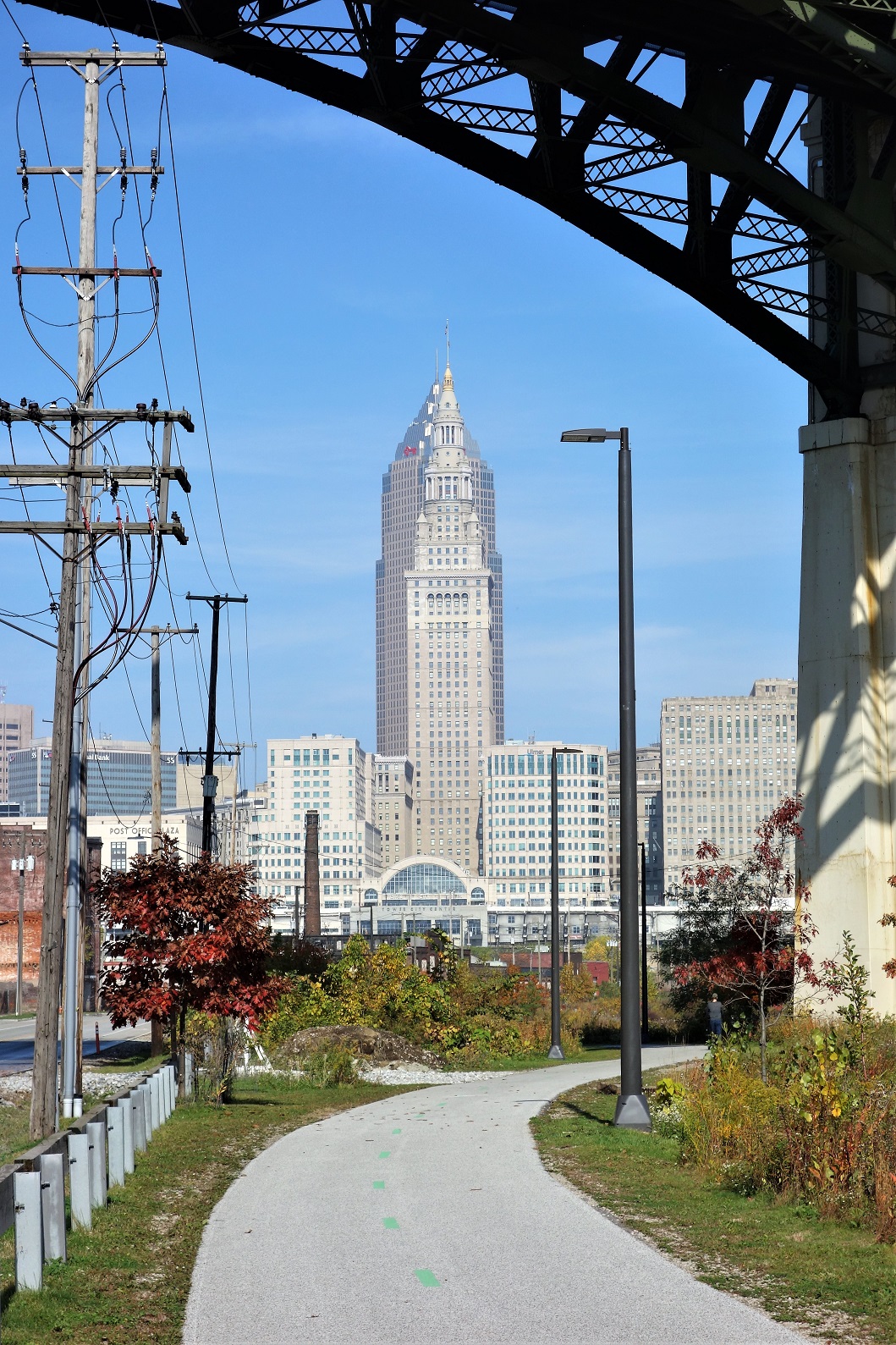


As I have mentioned before, the iconic Terminal Tower was the second tallest building in the world when it was completed in 1930.
The Towpath Trail ended, however I continued walking through the Flats. (I believe that there are plans to continue the Trail a bit farther to Lake Erie at the mouth of the Cuyahoga.)


On the bluff above the river, the old Warehouse District has seen old buildings renovated and new structures built. These are all condos and apartments for people moving back into downtown Cleveland.

The lower end of the Flats has had an up and down and up again history as an entertainment district. In the 80s and 90s the Flats had the highest concentration of bars in the Midwest. The era of drunken revelry came to end after some shootings in the district. The bars closed down and the area became a ghost town. However in recent years the Flats are reviving again with the emphasis on riverfront dining more than bars.


Cleaveland and his party from the Connecticut Land Company set up their camp here. They climbed the bluff, and plotted out a townsite with a New England design centered around a Public Square. The settlement was to be called Capital Town, but instead (with a misspelling of his name) came to named after its founder. Cleaveland then returned to Connecticut and never came back to Ohio. The next year, another Connecticut native, Lorenzo Carter, bought a plot of land and became the first resident of what would become Cleveland, Ohio.

These are lovely photos of this corner of the CLE, Bill.
ReplyDeleteThanks, Gail. It was a beautiful, sunny day, and the trail provided an interesting perspective of downtown Cleveland.
Delete